To enable the sharing of diverse, personally situated forest stories, we experiment with speculative material practices and devices, including the online Feral Map – a collaborative dataset of diverse, more-than-human forest experiences and knowledge (with over 150 stories so far). Through the Feral Map, the project aims to entangle the currently available – mostly quantitative – forest datasets and extractivist understandings of forests with more messy, colourful and eclectic inputs – or what we call feral data.
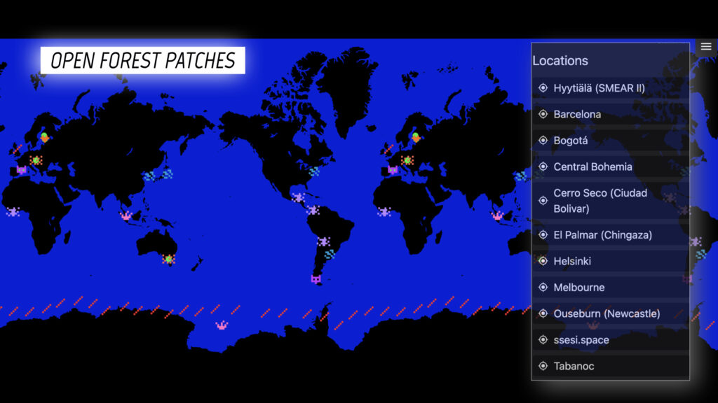
The map makes the collected forest stories available for further reflection and asynchronous engagement outside of the walks’ scope, to reach broader audiences. Each forest patch where we have organised the walks is added to the map as a new location to collect local stories. However, map contributions are not limited to the forest patches we have directly engaged with, as a story can also be added anywhere outside of these locations. Anyone, including those who did not participate in the walks, can share their stories, in any forest location they like, thus contributing to an evolving dataset of diversely situated forest experiences and observations.
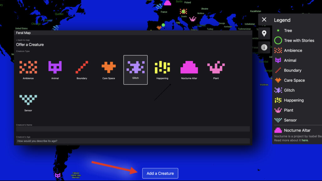
Apart from adding stories to the existing forest places and data points already documented in the Map, participants can also add new points of interest, or ‘new creatures’ as we call them. Offering these new creatures to the map is left deliberately open: participants can add creatures of various kinds, such as an animal or plant, but also more abstract ones such as an ambiance or a glitch. By adding these new creatures, they can propose what is missing from the forest map while drawing on their personal and locally situated knowledge, and help make visible what might not be visible otherwise.
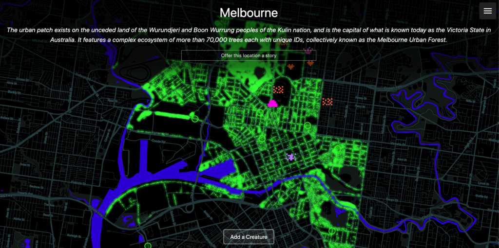
Besides the content added by participants, the map has been seeded with data points generated automatically using various existing, open and publicly available forest datasets capturing details of the forest patches where we have walked. For instance, we have used the urban forest datasets maintained by the city of Melbourne and the city of Helsinki, which allowed us to include all trees that exist in these locations and are maintained and monitored by the local municipalities.
Having the Feral Map as our main portal to collect forest stories, we have organised multiple forest walks in various parts of the world, including (what is known today as) Finland, Australia, the Czech Republic, Colombia, and the United Kingdom.